
May 26, 2021 River Flows
Real-Edwards Conservation & Reclamation District River Flows
All river flow measurements were taken on Wednesday, May 26, 2021, before the rains blessed us. We are thankful for the rain this past week, and pray for more. Many have received an abundance, and some have only received a small amount. In this area, we will take it! This is a great time to harvest rainwater to save for a dry spell. Rainwater is great for the garden or other outdoor chores.
REMINDER: Both Edwards and Real counties are in a Stage 3 Drought status. Now is the time to begin conserving water by using what you have efficiently.
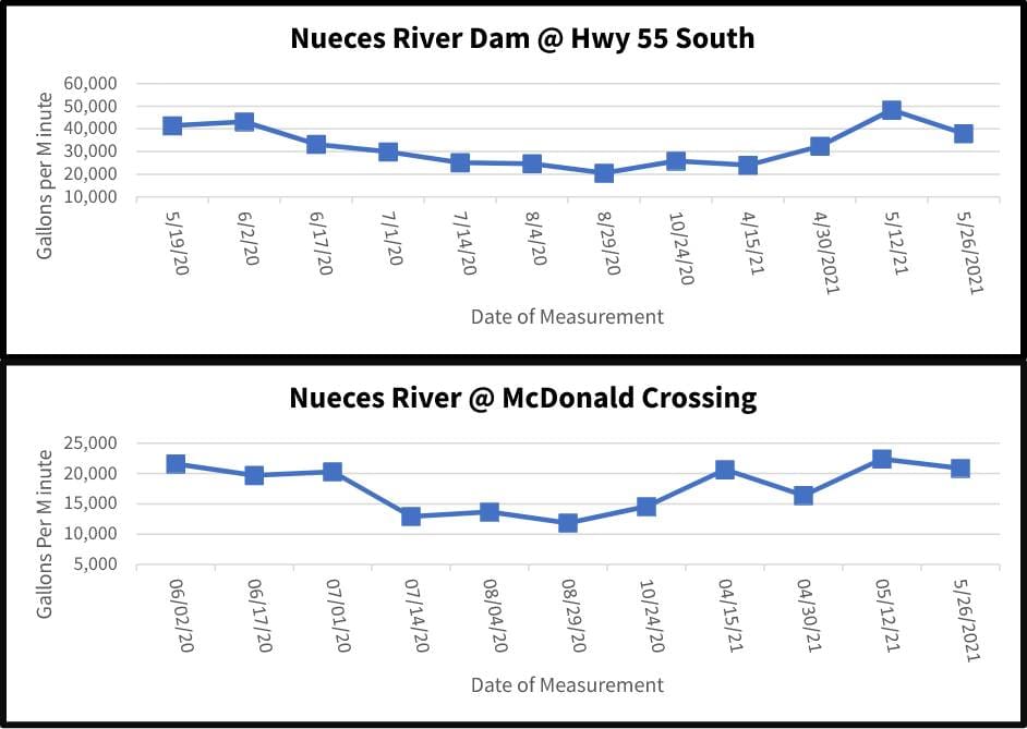
The Nueces River crossing at Highway 55 South of Camp Wood near the dam decreased its flow from the last measurement taken May 12, 2021, from 48,409 gpm to the current reading 37,976 gpm. At the McDonald Road crossing, the Nueces River decreased from 22,412 gpm to 20,861 gpm
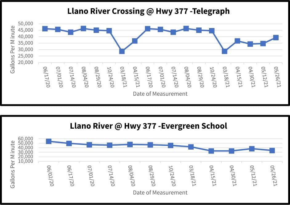
The South Llano River dips into northern Edwards County where it borders Kimble County and crosses Highway 377 twice. For the crossing at Telegraph, the South Llano measured an increased measurementof 39,352 gpm from the last measurement of 34,686 gpm. The Evergreen School crossing showed a decrease to 34,004 gpm from the last measurement of 37,918 gpm.
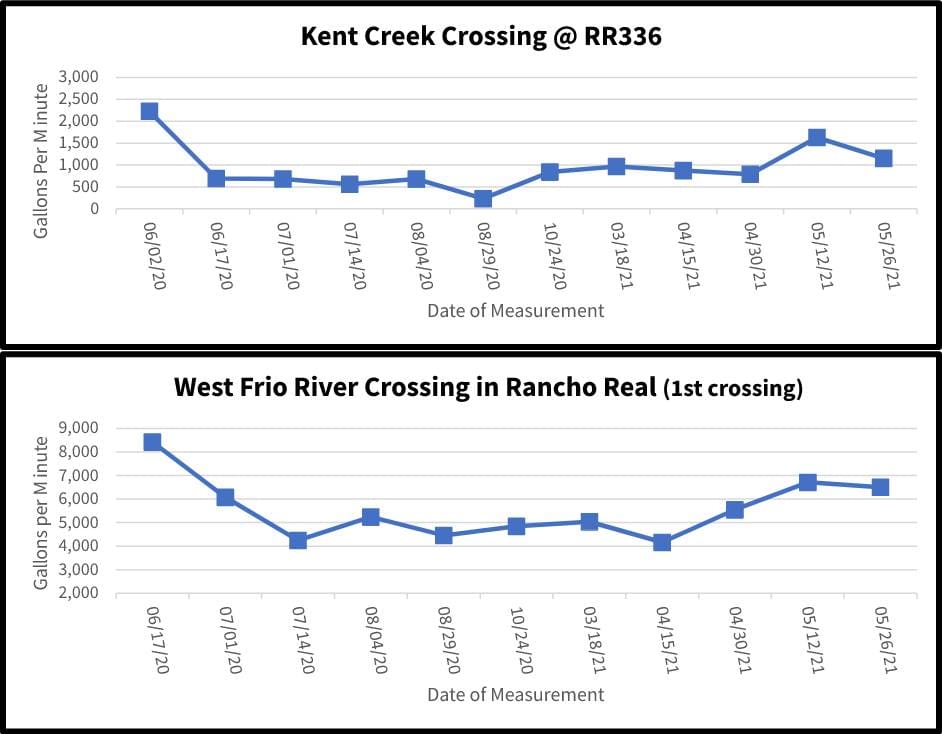
On Ranch Road 336 approximately 10 miles north of Leakey, Kent Creek crosses under the road and flows into the west prong of the Frio River. Kent Creek crossing had a decreased flow of 1,153 gpm from1,630 gpm. Also, on RR336 is Rancho Real where the west prong of the Frio River meanders through Rancho Real, at the first crossing there was also a decreased flow of 6,499 gpm from 6,710 gpm at last measurement.
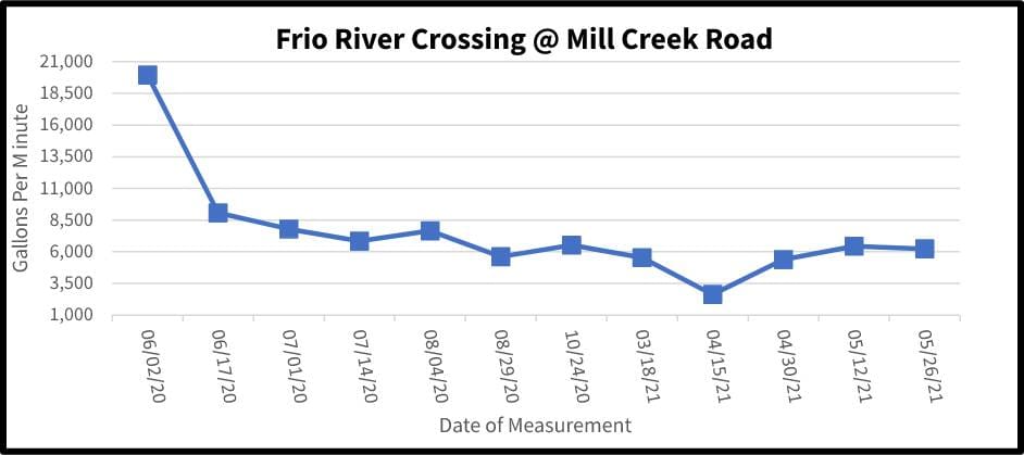
On U.S. Highway 83 north of Leakey, Mill Creek Road crosses the east prong of the Frio River before it merges with the west prong. This crossing showed a decreased flow of 6,244 gpm from the last measurement of 6,440 gpm.
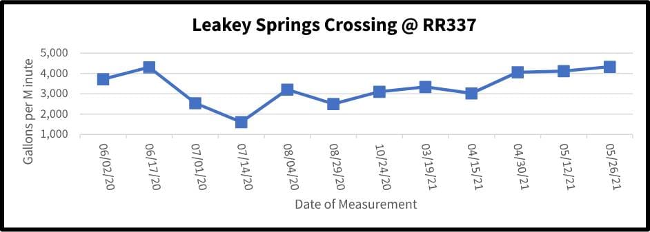
Following east on Ranch Road 337 past the cemetery is the serene Leakey Springs tributary of the Frio River. This crossing measure increased to 4,338 gpm from last measurement of 4,120 gpm.
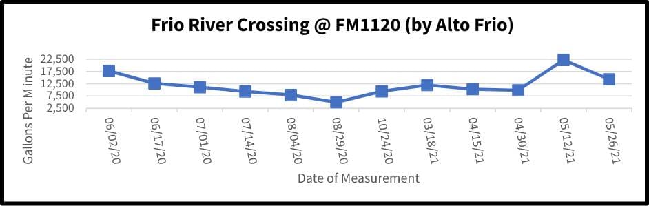
Traveling east on FM 1120 past the Alto Frio Baptist Encampment (also known as Fulgham’s Crossing), the flow decreased to 14,309 gpm from 22,197 gpm at last measurement.