
July 29, 2021 River Flows
Real-Edwards Conservation & Reclamation District
River Flows
All river flow measurements were taken on July 29, 2021. We are thankful for the intermittent rains this
summer. Remember, harvesting rainwater is a great solution for a future dry spell or as supplemental
watering for your garden.
REMINDER: Both Edwards and Real counties are in a Stage 3 Drought status. Now is the time to begin
conserving water by using what you have efficiently.
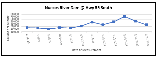
The Nueces River crossing at Highway 55 south of Camp Wood near the dam had a decreased flow of
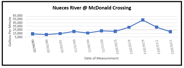
37,877 gpm, while last reading was 52,896 gpm. At the McDonald Road crossing north of Camp Wood,
the Nueces River also decreased in flow to 19,965 gpm from last measurement of 32,868 gpm.
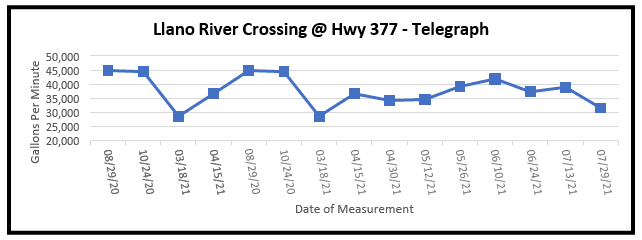
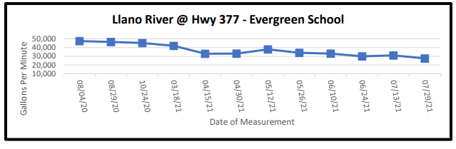
The South Llano River dips into northern Edwards County where it borders Kimble County and crosses Highway 377 twice where flows can be measured. For the crossing at Telegraph, the South Llano revealed a decreased flow of 31,672 gpm from the last measurement of 39,095 gpm. The Evergreen School crossing also showed a decrease of 27,616 gpm from last flow measurement of 31,024 gpm.
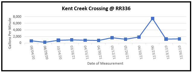
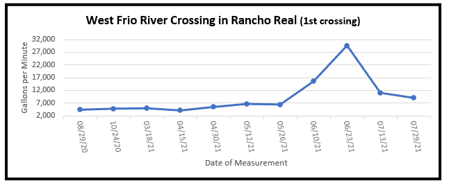
On Ranch Road 336 approximately 10 miles north of Leakey, Kent Creek flows into the west prong of the Frio River. Kent Creek crossing revealed a slight increased flow of 1,275 gpm from last measurement of 1,209. This is most likely due to several rain showers that week on the northern end of Kent Creek. Also, on RR336 is the Rancho Real subdivision where the west prong of the Frio River meanders toward Leakey. The first crossing in Rancho Real showed a decrease in flow of 9,079 gpm from last measurement of 11,104 gpm.
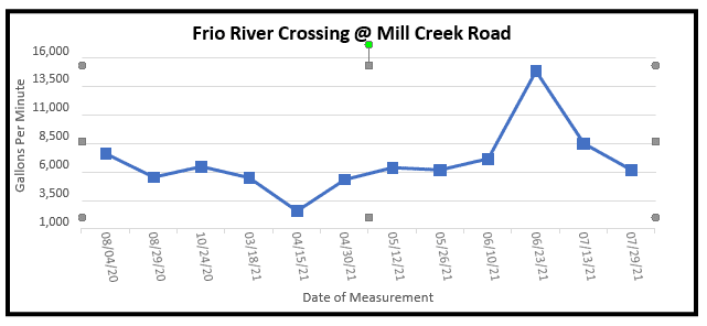
On U.S. Highway 83 north of Leakey, Mill Creek Road crosses the east prong of the Frio River before it merges with the west prong of the Frio River. Mill Creek crossing showed a decreased flow of 6,227 gpm from the last measurement of 8,551 gpm.
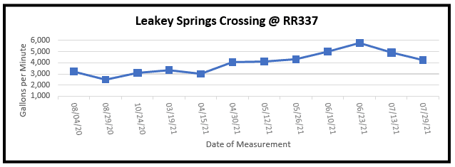
Moving slightly east on Ranch Road 337 past the Leakey Floral cemetery is the serene Leakey Springs tributary of the Frio River. This crossing revealed a slightly decreased flow of 4,252 gpm from last measurement of 4,934 gpm.
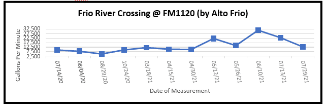
Traveling east on FM 1120 past the Alto Frio Baptist Encampment (also known as Fulgham’s Crossing), the flow showed a decreased measurement of 12,832 gpm from last measurement of 23,110 gpm.
Interesting how slight rain showers (as well as heavy downpours), heat, evaporation and other factors make a difference in our river flow measurements. Use our water sources wisely.