
July 13, 2021 River Flows
Real-Edwards Conservation & Reclamation District River Flows
All river flow measurements were taken on July 13, 2021. We are thankful for the sporadic, recent rains. Many have been blessed with light showers in the last several days. Remember, harvesting rainwater is a great solution for a future dry spell.
REMINDER: Both Edwards and Real counties are in a Stage 3 Drought status. Now is the time to begin conserving water by using what you have efficiently
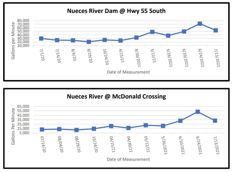
The Nueces River crossing at Highway 55 south of Camp Wood near the dam decreased in flow from the last measurement of 71,760 gpm to the current reading 52,896 gpm. At the McDonald Road crossing north of Camp Wood, the Nueces River decreased from 52,887 gpm to a current flow of 32,868 gpm
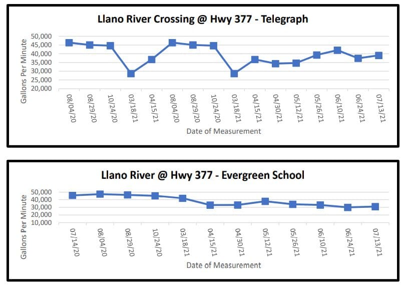
The South Llano River dips into northern Edwards County where it borders Kimble County and twice crosses Highway 377. For the crossing at Telegraph, the South Llano currently shows a measurement of 39,095 gpm a slight increase from the last measurement of 37,440 gpm. The Evergreen School crossing showed an increase to 31,024 gpm from the last measurement of 29,996 gpm.
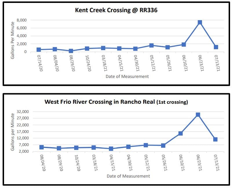
On Ranch Road 336 approximately 10 miles north of Leakey, Kent Creek crosses under the road and flows into the west prong of the Frio River. Kent Creek crossing had a decreased flow of 1,209 gpm from 7,454 gpm. Also, on RR336 is the Rancho Real subdivision where the west prong of the Frio River meanders toward Leakey. The first crossing in Rancho Real showed a decrease in flow to 11,104 gpm from 29,761 gpm at last measurement.
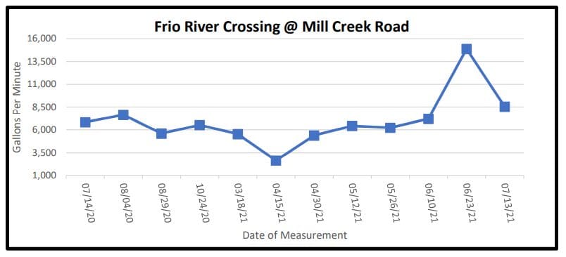
On U.S. Highway 83 north of Leakey, Mill Creek Road crosses the east prong of the Frio River before it merges with the west prong of the Frio River. This crossing showed a decreased flow of 8,551 gpm from the last measurement of 14,880 gpm.
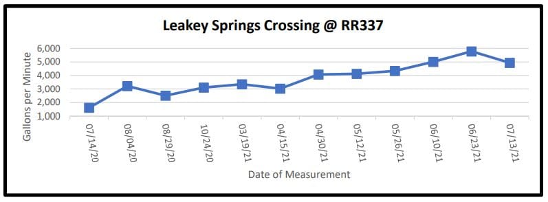
Moving east on Ranch Road 337 past the cemetery is the serene Leakey Springs tributary of the Frio River. This crossing measure decreased to 4,934 gpm from last measurement of 5,784 gpm.
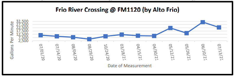
Traveling east on FM 1120 past the Alto Frio Baptist Encampment (also known as Fulgham’s Crossing), the flow at last measurement on June 10th was 31,431 gpm. Due to high water, no measurement was taken on June 23rd. Current measurement is 23,110 gpm which is a decrease from the June 10th measurement.